


AI-Powered Airspace Intelligence for Cities, Airports, and Public Safety
Meerir connects a proprietary, real-time ADS-B feed to a large language model, so airport managers, city planners, and the public can ask what's flying overhead and get decision-ready metrics in seconds.

Airspace telemetry, turned into plain-English answers
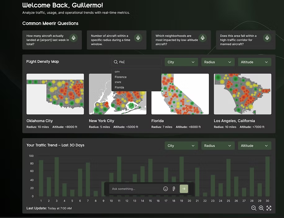
DronePort Network is piloting Meerir, an AI platform that turns low-altitude airspace telemetry into plain-English answers and simple visuals.
The MVP connects a proprietary, real-time ADS-B feed to a large language model so airport managers, city planners, and the public can ask questions and get decision-ready metrics in seconds.
Below 4,000 feet, the sky is busy and the data is hard to read
Below roughly 4,000 feet, the sky is busy: traditional aircraft, drones, and emergency operations share the same airspace. The data about it is fragmented, hard to access, and difficult to interpret without deep aviation expertise, which slows planning, grant work, and public-safety decisions.
Stakeholders needed an accessible way to see what's flying overhead and quantify activity around local airports.
Fragmented
Telemetry scattered across sources, with no single place to ask a question.
Hard to access
Getting at the data meant tooling and time most stakeholders don't have.
Hard to interpret
Raw feeds need aviation expertise before they mean anything to a planner or a council.
A live feed, a language model, and the guardrails between them
Meerir ingests and preprocesses the real-time ADS-B feed, applies geospatial filtering and time-series aggregation, and hands the result to a large language model that answers in plain language. Guardrails on coordinates and uniqueness rules increase reliability on time-series telemetry.
The language model never guesses at the numbers. The metric is computed from live data first, then explained.
Decision-ready insights in seconds
A production MVP now returns accurate, plain-language answers from live telemetry in seconds. Early stakeholder feedback confirms commercial potential for communities and public-safety teams, and the platform gives airport operations faster situational awareness, planning support, and baseline analytics.
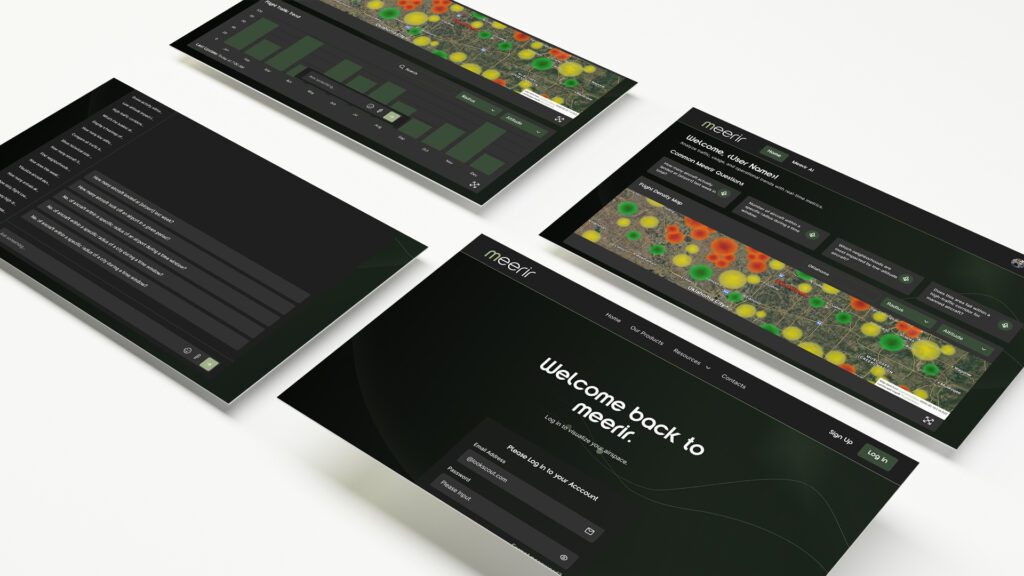
A functioning conversational AI interface powered by large language models.
Robust ADS-B ingestion and preprocessing for reliable analytics.
Initial visuals focused on traffic density and airport operations.
A scalable foundation for dashboards, new feeds, alerting, and expansion.
Validated market need: early stakeholder feedback confirms commercial potential for communities and public-safety teams
Natural-language access lowers barriers for non-experts and speeds insight
The kind of question Meerir answers
Three example outputs for Tulsa International Airport (TUL), computed from the live ADS-B feed. They illustrate the queries the platform handles; they are not engagement results.
unique aircraft within 5 miles of TUL below 4,000 ft, last 30 days
unique aircraft in the busiest hour, 17:00, within 5 miles of TUL below 3,000 ft, last 30 days
average ground speed between 500 and 4,000 ft within 3 miles of TUL, last 60 days
Sample query outputs as published by DronePort Network. Windows and radii are part of each query, and results change as the live feed does.
From MVP to the operational picture
Guardrails on coordinates and uniqueness rules increase reliability on time-series telemetry, and natural-language access lowers barriers for non-experts and speeds insight. The roadmap builds on that foundation.
Dashboards
Ship dashboards on top of the conversational interface.
New feeds
Integrate Remote ID and radar alongside ADS-B.
New geographies
Expand beyond the initial airports and cities.
Pilots
Run pilots with airport managers, city officials, and public-safety teams.
Alerting
Add alerting on top of the live telemetry.
Report packs
Package answers for grants and council updates.
In their words
“Designed to make low-altitude airspace data understandable and usable by everyone… It's not scraping the web—it's pulling real-time ADS-B data and analyzing that.”
 Craig MahaneyCEO, DronePort Network
About the work

About DronePort Network
DronePort Network is a national leader in autonomous systems integration and infrastructure development. The company works closely with cities, states, tribal nations, and federal agencies to support the deployment of Beyond Visual Line of Sight (BVLOS) operations, drones as first responders (DFR), and emerging air mobility technologies. Through the Secure Autonomy Feedback and Evaluation Test Bed (SAFE-T) initiative and other groundbreaking projects, DronePort Network is creating the backbone for trustworthy, autonomous aviation ecosystems across the United States.

HatchWorks AI turns AI into ROI by automating key business processes, transforming data, deploying intelligent agents, and shipping AI-powered products that deliver measurable results. Its proprietary Generative-Driven Development methodology is a repeatable path from idea to production, blending AI, agents, and engineering to ship faster with less risk.
Sitting on data your stakeholders can't read?
See how HatchWorks AI connects live feeds to language models, with the guardrails that keep the answers right.